Monday, August 30, 2010

THE LITTLE MISSISSIPPI RIVER - Into the Conroy Marsh

Monday following our short trip on the York, Rudi and I abandoned Alexander with mommy and headed out to the Burnt Bridge Road put-in, this time heading north along the Little Mississippi and into the Conroy Marsh. Total trip time was roughly two hours paddling, with a fifteen minute break exploring a point with a couple of rock ringed firepits, Rudi excitedly proclaiming there to be an abundance of minerals, including quartz, mica, and fools gold present in some of the rocks. 


Noodling down the Little Mississippi. The main channel generally is about 75' to 150' wide, in a wider wetland from 300' to 500' or wider here


The channel widens out, and the opening of the Marsh appears. The long line of hills trends to the Northwest, leading the marsh to its outlet in Negeek Lake near Combermere


Another view of the opening into the Conroy Marsh. Around the small headland on the right, the marsh opens up to roughly two or threee kilometres wide


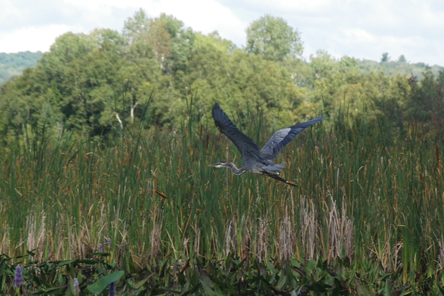
Once again we played leapfrog with a pair of Great Blue Herons, and this time I was able to shoot one... Finally!


Sedge Bending! The term courtesy Richard Powell, author of "100 Lakes On Vancouver Island", click to visit his absolutely stunning blog!


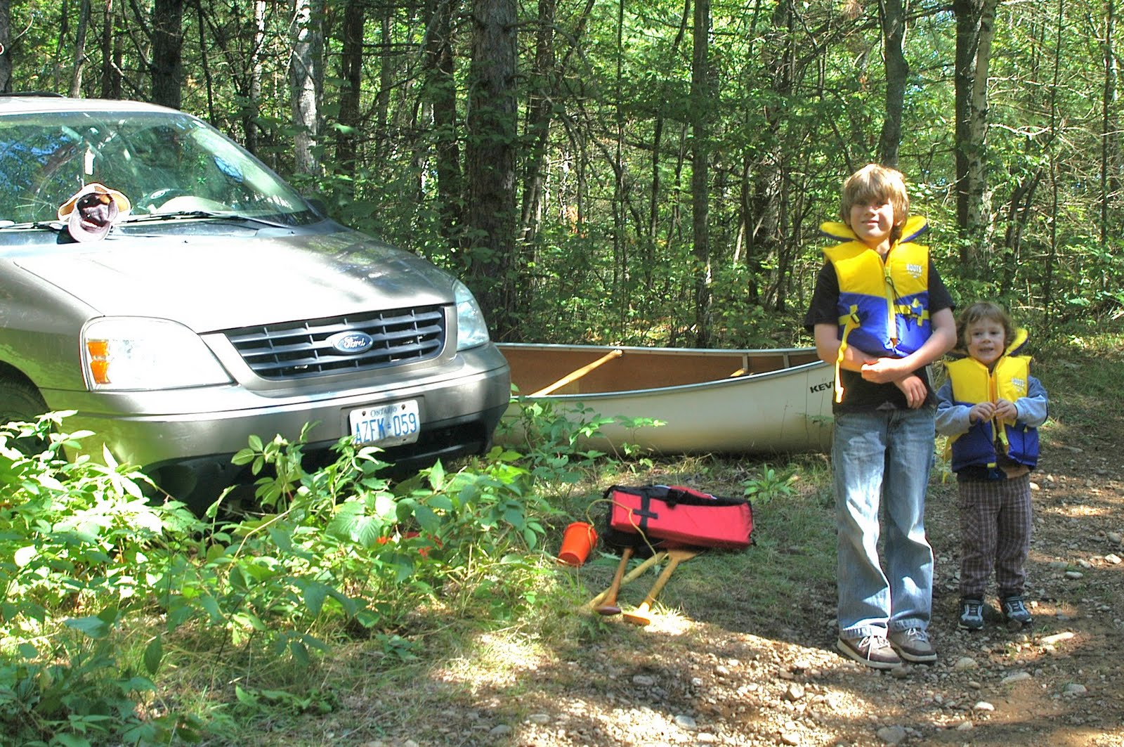
Almost back to the put-in, the Burnt Bridge Road bridge over the river is just visible, as well as the trusty Ford Freestar!


Yes, the little (big) kid does paddle a bit! A well graded boat launch we used for our put-in is directly ahead of the canoe

Sunday, August 29, 2010

THE YORK RIVER - Back to the 'Hunt Camp on York'

After returning toward our put-in, we stopped to chat again with Gus Zylstra who we met on the way out. Gus owns a house and some rental properties in the area, and is also owner of Pinecone Publishing, the complany that publishes The Country Connection, an awesome little magazine covering country and cottage life, especially local to Eastern Ontario 


Gus and friend (oops forgot to ask her name) at the Pinecone Forest


A much needed break

Saturday, August 28, 2010

THE YORK RIVER - Conroy Rapids

After passing our put-in and continuing downstream, we caught a pair of kaykers exploring the shoreline, and eventually rounded a corner, hearing the unmistakable roar of rushing water. Not a really load roar, but these rapids only drop the river about five or six feet vertically over a hundred yards or so. We noodled about above the rapids for a few minutes, testing the flow, and getting a few photographs, then headed back upstream toward the put-in.


Approaching the Conroy Rapids


These two look rather bored, as opposed to absolutely terrified of their impending doom~!


Another view of the raging torrent!

Friday, August 27, 2010

THE YORK RIVER - 'Hunt Camp on York' to Slabtown

Slabtown Ontario is home to approximately three-fifths of one one-millionth of the population of Canada, so it is unmarked on any maps, and the average person has a better chance of winning the Lotto Max Jackpot than of ever accidentally wandering into this little town.

Rudi, Alexander, and I found it by following the old 517 from Combermere, the Boulter Road, Rivercrest Drive, and finally an old MNR track barely suitable for passage by the van. A few hundred metres from where we parked, we found a suitable put-in at a clearing with a small hunt cabin, and then headed east along the York to the Boulter Road Bridge in Slabtown.


Gearing up after parking on the old MNR forest track.


Passing a cottage located in Slabtown, on the south side of the York


The Boulter Road bridge at Slabtown


Returning past our put-in at the hunt camp on the York River

LinkWithin

Related Posts with Thumbnails