Showing posts with label Combermere. Show all posts

Tuesday, August 27, 2013

CONROY MARSH - July 2013

The day after our Barron Canyon trip, Rudi, AJ, Alexander and I headed out to the Conroy Marsh for what was intended to be an overnight canoing and camping adventure. The plan was to put in at Burnt Bridge Road on the Little Mississipi river, traverse the length of the marsh, taking out across Negeek lake at the MNR dock and spending the night there. Katherine would drop us off, and then meet us that evening with our tent and supplies that evening, and then the next day we would leave the MNR dock on Negeek, and take a shorter paddle up to Combermere and the take out in town.

It all started out well, albeit a little bit windy, and with those vaguely ominous little puffy clouds scudding southward overhead. Paddling was a little tough, be we made decent time down the Little Mississipi to our first break at the point that marks the entrance to the marsh.

On entering the marsh, the wind picked up a bit, and made paddling more challenging. Additionally, just over the Craigmont hill it appeared a squall had formed, and had us right in its path. I decided to try to cover more water, and lashed the boys canoe to mine to keep them in line, and really dug in. Still, progress was slow, and sure enough in less than twenty minutes the nasty weather hit, wind driving at least 50kmh, heavy rain, and the water on the marsh pushing back up into half foot tall standing waves.


Entering the Conroy Marsh on the Little Mississippi River, the marsh opens up to the right, the York River enters behind the trees directly ahead of our canoes.


AJ, Alexander and Rudi posing at our lunch stop, a small point of land that demarks the point the Little Mississippi enters the Conroy Marsh.


This was likely after we got drenched in the squall, the winds too high and the time to late to make it to the other end of the marsh, I decided to turn back.

Monday, August 1, 2011

CASSON AND THE CONROY MARSH - PART 2

After stopping in Combermere at the internet hotspot / cafe / laundromat for a maple blend coffee and to find out if there is a fair place to put on the north side of the Conroy Marsh, we drove south on old highway 517 and then Lower Craigmont road to the hamlet of Mayhew Landing. Unlike the vast majority of Ontario cottage country, the road access here was on the lake side of the waterfront properties, and in Ontario would generally be considered a public allowance: I tried knocking on two of the cottages closest to the end of the road to ask if we could use their waterfront or even dock to put in, though there was no answer. We took our gear and canoe to the first dock, and loaded up.

Immediately looking out to the left, the marsh continued just a few hundred metres before opening into Negeek Lake on the Madawaska River. This is where the marsh channel, actually the York River, ends and empties into the Mighty Madawaska.

We turned west, and paddled into the marsh, which stretched away at least five miles in front of us. Just fifteen minutes of easy paddling brought us to a large beaver lodge. As we approached within about fifty feet, there was a quick flash of brown, and a large slap of a beaver tail against water! Knowing that they were aware of us now, we turned to the left and away from the lodge. Immediately beneath and to the right of the canoe there was a large turbulence of the bottom silt, with large clouds of muck roiling away underneath and alongside the canoe, moving ahead as we paddled forward. A panicked thought of  mammoth canoe tipping beavers flashed into my mind, quickly dispelled of course! Within half a minute, a brown head popped up fifty yards ahead of the canoe! We paddled towards it, and after closing half the distance, he dove under, only to appear a few hundred feet further along. 


Looking east from Mayhew Landing, across the York River, and the outlet of the Conroy Marsh, to the hills across Negeek Lake (hidden from view behing the low bank of green).


Paddling westerly, about 500 metres from Mayhew Landing. A large beaver lodge is ahead of the canoe. The 'mountain' in the background is about two to three miles away, and is the location of the historic Craigmont corundum mine.


A close up of the beaver lodge, The Conroy Marsh enables lazy beavers, as they do not have to do any dam building whatsoever..

Thursday, July 21, 2011

THE REPLACEMENTS!

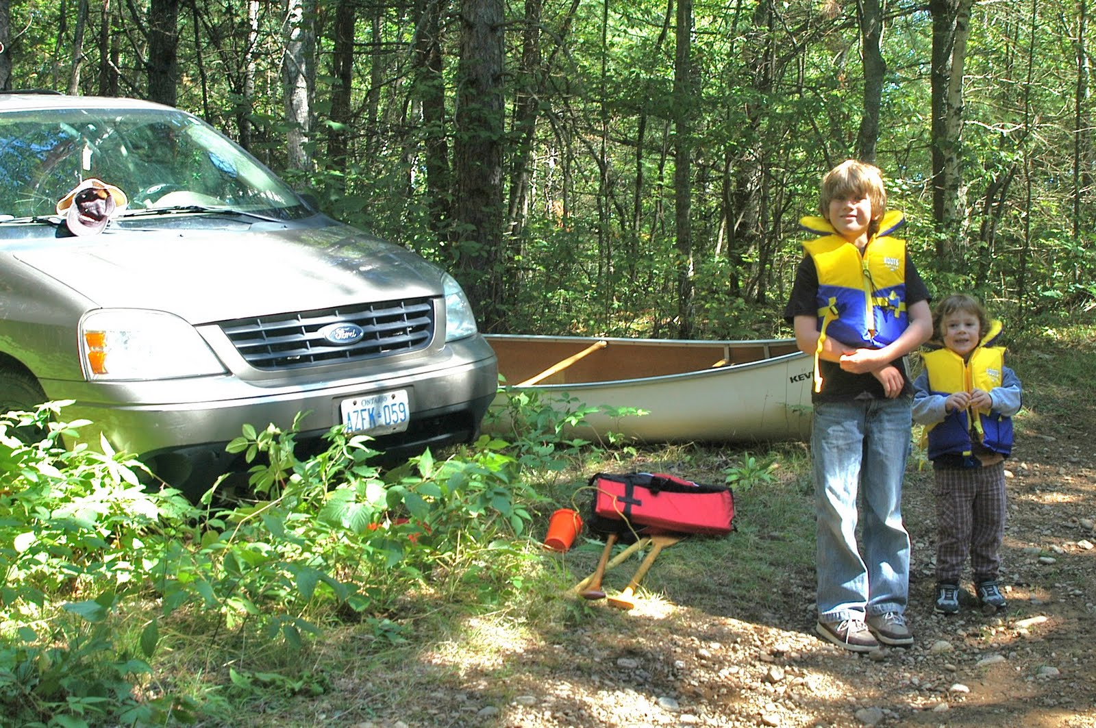
We finally got to the cottage for the first time this year, and on the way, picked up an older, relatively well used, repainted fibreglass canoe, for use while the 'Cottage Coleman' undergoes it's slow and tedious restoration. I needed to find a canoe for a hundred and change, and not out of the way of our drive up to Barry's Bay. A few visits to Kijiji later, and I found a gentleman selling a canoe located just outside of Bancroft. She ain't pretty, but she floats, holds a line well, and paddles easily. Here is a picture of Rudi with our gear after taking out of the Conroy Marsh at Mayhew Landing near Combermere.


Friday, August 27, 2010

THE YORK RIVER - 'Hunt Camp on York' to Slabtown

Slabtown Ontario is home to approximately three-fifths of one one-millionth of the population of Canada, so it is unmarked on any maps, and the average person has a better chance of winning the Lotto Max Jackpot than of ever accidentally wandering into this little town.

Rudi, Alexander, and I found it by following the old 517 from Combermere, the Boulter Road, Rivercrest Drive, and finally an old MNR track barely suitable for passage by the van. A few hundred metres from where we parked, we found a suitable put-in at a clearing with a small hunt cabin, and then headed east along the York to the Boulter Road Bridge in Slabtown.


Gearing up after parking on the old MNR forest track.


Passing a cottage located in Slabtown, on the south side of the York


The Boulter Road bridge at Slabtown


Returning past our put-in at the hunt camp on the York River

Saturday, July 11, 2009

RESEARCH, AND THE DRIVE HOME


I left the cottage today for home, driving a route I had never taken before. Down the 517 out of Combermere, then South at the end headed for Boulter. About two kilometres south of the intersection, the road passed through a little hamlet, and crossed a bridge over the York River. Here I slowed down, and checked the river... Deep, slow, and wide, absolutely perfect!

So that is the second part of the research done for our next big adventure, which will be to put in the York off the Boulter road bridge, paddle the York down about 3 kilometres into the Conroy Marsh, and then the 8 kilometer length of the Marsh. I had earlier called a gentleman in the area who gave me a good idea what to expect on the York River between the put-in and the Marsh, being two sets of small rapids, and how best to negotiate them. Stay tuned for an even bigger adventure with my favorite bowman Rudi sometime in August!

Thursday, July 9, 2009

PADDLING THE CONROY MARSH


I got away with my little bowman Rudi on a big canoe adventure today, a three hour trip across Negeek Lake and into the Conroy Marsh and back. We drove down the Palmer Rapids Road South of Combermere (Highway 515), and found a cottage access road north of Jewelville that ended near the Southern end of Negeek Lake (Negeek is tha large body of water on the Google Earth map, top left), with a little track maintained by the MNR that led further to a grassy turnaround, and an old boat launch with a short log crib pier (Top photo). Ten minutes later the canoe was in the water and we were paddling across the shallow lake. I had to overcome my ridiculous fear of shallow water - for some reason I get really nervous about what is coming up underneath the boat, and I get the willies when I can see the bottom vegetation and muck. I think it has to do with the fact I would probably freak out if the boat got upset, and I had to swim in all that crap, so I reassured myself that there was no way in hell the Canadian was going to tip over on flat water on a warm, calm summer day!

It was fairly easy to find the entrance to the York River across the lake, up which the Conroy Marsh wandered, and we paddled through the wide river mouth, with a line of steep hills to our right, and most of the marsh and further hills off to the left. By this time I'd overcome my fear of the shallows, and was paddling close to reeds and lilies, not worried about the murky bottom (Middle photo). For about half an hour we paddled Southwest, mostly along the main channel, and then exploring some side channels on the South side of the main.

The side channels were of a consistant width, about thirty feet or so, and were divided by hillocks of probably spongy waterlogged ground, supporting in some cases small stands of trees (Bottom photo). In other areas, some mammoth rock outcroppings rose above the surface, around which these channels formed. Paddling quietly down one, we surprised a Buck, who looked up, decided we were a bit of trouble, and bounced away to the South. Rudi was very excited, as we had just rounded a corner, and the Deer was less than 80 feet away. We also saw a number of geese, a variety of ducks, and a pair of Great Blue Heron. After spending another half hour or so checking out various little channels, we found the main course again, and headed back down river to Negeek Lake, then across and back to the put-in. The canoe handled nicely, stable and predictable, and was quite easy to paddle, even for a relative novice like me. Rudi does have a bit of improving to do, as more often than not his paddle is in the boat, not the water!

LinkWithin

Related Posts with Thumbnails